How to Check For Snow on The Trail

Exploring Above the Snow Line During a Trail Running Workshop - Photo Steven Mortinson
Spring is here and the hot May sun is beating the snow line back into the alpine. At this time of year I start getting antsy to swap my ski boots for trail runners and do some mountain runs. The biggest challenge of spring mountain running is figuring out which trails have melted out and which are still snowed over.
When planning mountain runs in the early-season, I evaluate snow level carefully. Getting the calculation right means the difference between a pleasant mountain loop and mind-numbing hours of postholing getting back to the car.
Here’s my process for checking the snow before I go.
Note: Caltopo and Gaia GPS provide me with free or discounted accounts, but provide no incentive, reward, or input for my writing about their tools
Step 1: Draw Some Route Options
My preferred route planning tool is Caltopo and I’ll describe that tool first. Later, I’ll explain similar functionality in Gaia GPS.
Below are a couple of favorite early season routes drawn in Caltopo:
Safe Option: Multnomah Falls - Wahkeena Falls - Angels Rest (Red)
Snow Likely Option: Multnomah Falls - Larch Mountain (Blue)

Spring route options drawn in Caltopo
Step 2: Use Satellite Imagery to View Snow Level
Caltopo provides access to a variety of regularly updating satellite layers. I find the ‘Sentinel Weekly’ layer to be a good mix of resolution and refresh rate.
Note: Satellite layers in both Caltopo and Gaia GPS require a ‘pro’ subscription

Layers are accessible via the right side panel

Satellite layers are available at the bottom of the list
Selecting ‘Sentinel Weekly’ gives the following:

Not very useful - clouds obscure the ground during the latest satellite flyover on 4/22
Use the layer options to select a different flyover, until you get a clear view of the ground:
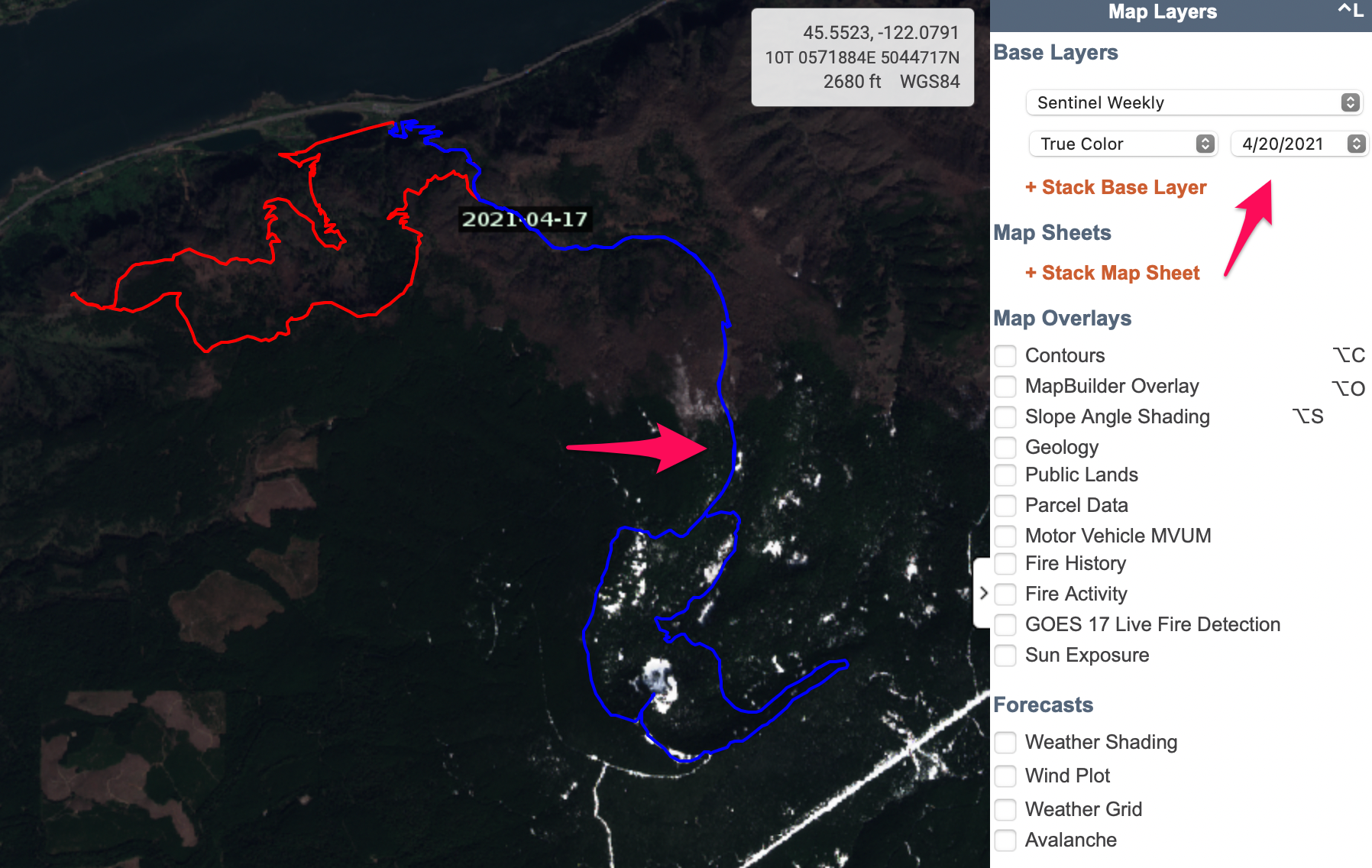
That’s more like it. 4/17 was a clear day and gives us a view of the ground. Arrow shows first visible snow.
The above satellite image shows our Multnomah-Wahkeena-Angels Rest loop option to be snow free. There is snow on Larch Mountain, let’s investigate.

Hovering the mouse pointer over the first snow location gives an elevation of ~2800'
Using the mouse pointer we’ve established that the snow line is around 2800’. Larch Mountain summit is at 4,000’, so this means we’ll be in the snow for the last ~1200’ vertical
Keep In Mind
Finding snow line with satellite images is easier in areas with minimal tree cover (duh)
Patchy snow in the satellite image likely means consistent snow in the trees
South and West aspects melt out faster and generally have lower snow lines in the spring
With the above in mind, I have enough information to make a call. In this case I ended up running the Larch Mountain Loop and enjoying generally good conditions with the snow line right where I expected it.
In the Field - Finding Snow Level Using Caltopo and Gaia Apps
The process using the Caltopo phone app is the same as the web app:

Selecting a layer in the Caltopo app
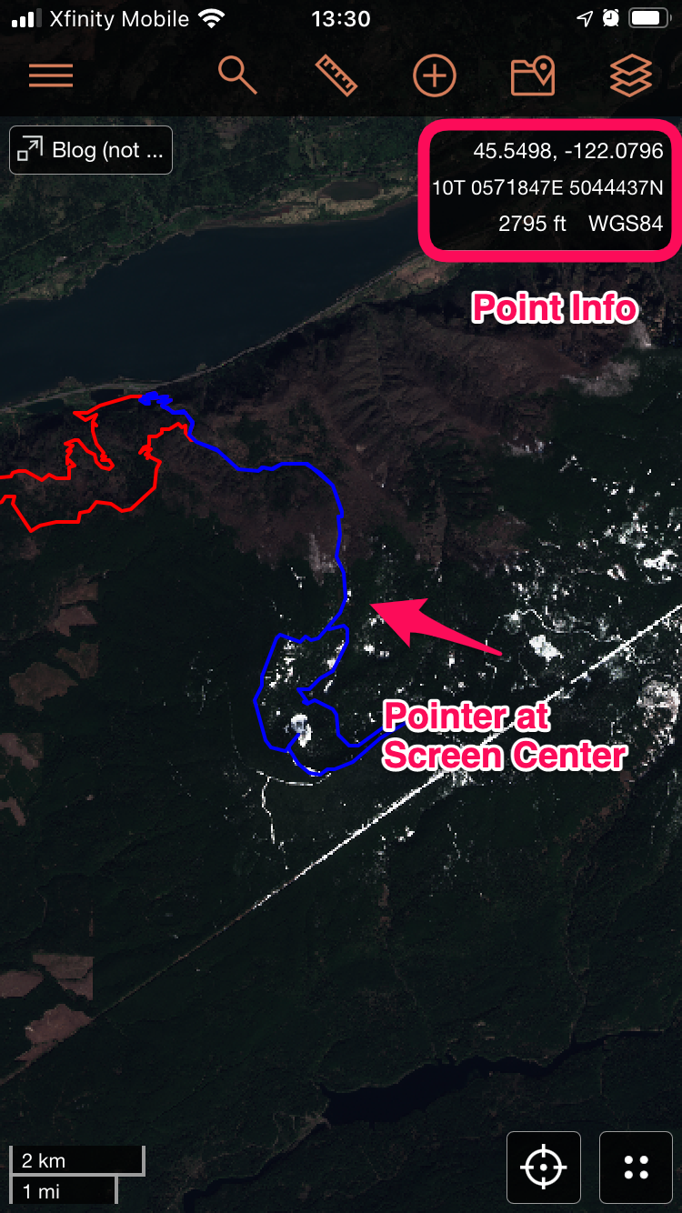
Determining point info in the Caltopo app
Gaia GPS App
I use the same process in Gaia GPS except that I substitute the ‘Snow Depth’ layer for satellite imagery. Gaia’s Snow Depth layer uses the Snow Data Assimilation System (SNODAS) to provide snow depth in a heat map layer. Based on my unscientific research, the SNODAS layer seems to correlate well with satellite images and offers a good-enough approximation of the amount of snow you’re likely to encounter.
Note: Gaia GPS offers similar satellite layers to Caltopo in the ‘FreshSat’ and ‘FreshSat Cloud Free’ layers, but I haven’t used them. If you have a Gaia subscription, they’d be worth exploring.

Select info in the Gaia GPS app

Adding a layer to the Gaia GPS app
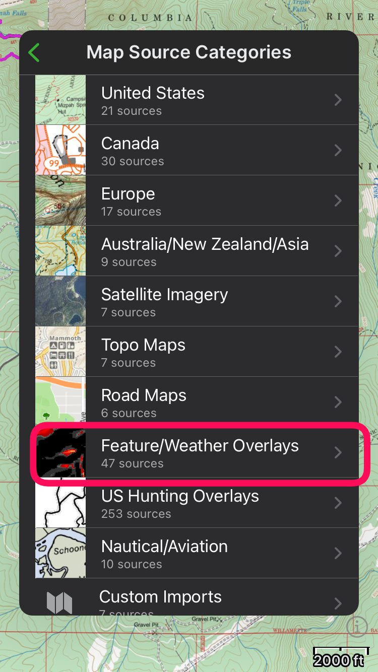
Snow Depth under weather overlays

Select the snow depth layer

Adjust opacity - around 50% works well
Once you’ve added the Snow Depth layer and adjusted opacity, you’ll be able to see snow depth information overlayed on your base map:

First snow shaded in Gaia GPS

Snow depth layer information
Honorable Mention - Snotel Sites
Snotel sites are automated weather reporting stations managed by the National Water and Climate Center. They can provide valuable realtime data, but their locations are limited and likely aren’t near your route. If possible, use a station at the same elevation and aspect you plan to travel.
View Snotel sites as a realtime data overlay in Caltopo, or click here: Snotel
Getting a good idea of the snow line before you leave home can save you some serious headaches on the trail. Don’t worry too much about getting the snow line exactly right. Be smart about your route planning and have some backup options should you encounter more snow than you expect.
Questions or feedback? Drop me a note in the comments.

Me enjoying some firm spring snow - Photo Steven Mortinson
